MUSKINGUM COUNTY OHIO


SURROUNDED BY:
|
|
COUNTY INFORMATION
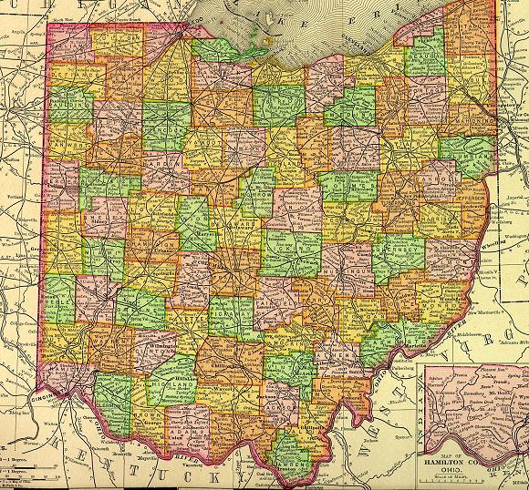
1895 Map of Ohio
(Click on Thumbnail
for Large Map)

Map modified with permission
of Ray Sterner from http://fermi.jhuapl.edu/states
DATE CREATED
1804
PARENT COUNTY
Washington, Fairfield
COUNTY SEAT
Zanesville
|
|
|

|
MAGGIE'S SKELETON CLOSET AKA PLACES TO SEEK YOUR ANCESTORS |

|
Muskingum County Probate Court
401 Main St.
Zanesville, OH 43702-0000
740-455-7100
Muskingum County Health
207 N 7th St, Zanesville, OH 43701
740-454-9741
Zanesville City County Health
205 N 7th St, Zanesville, OH 43701
740-454-9741
John McIntire Library
220 N 5th St, Zanesville, OH 43701
740-453-0391
OTHER INFORMATION
Muskingum County is located about 50 miles east of Columbus. Muskingum is an old Delaware Indian word meaning "a town by the river".
Zanesville was the state capital of Ohio from 1810-12 and is now the Muskingum county seat. In 1814 on of the first Y-bridges in the world was constructed across the Licking and Muskingum Rivers. It is possible to cross the Y-bridge and stay on the same side of the river.
Cement is an important industry in the county. Other industries include; machinery, metals, stone-clay-glass, printing and publishing, food, paper, glass containers, cardboard boxes, ceramic tile, electric transformers, kitchenware, cattle, calves, and dairy products.
|
|