Maps of Islay
|
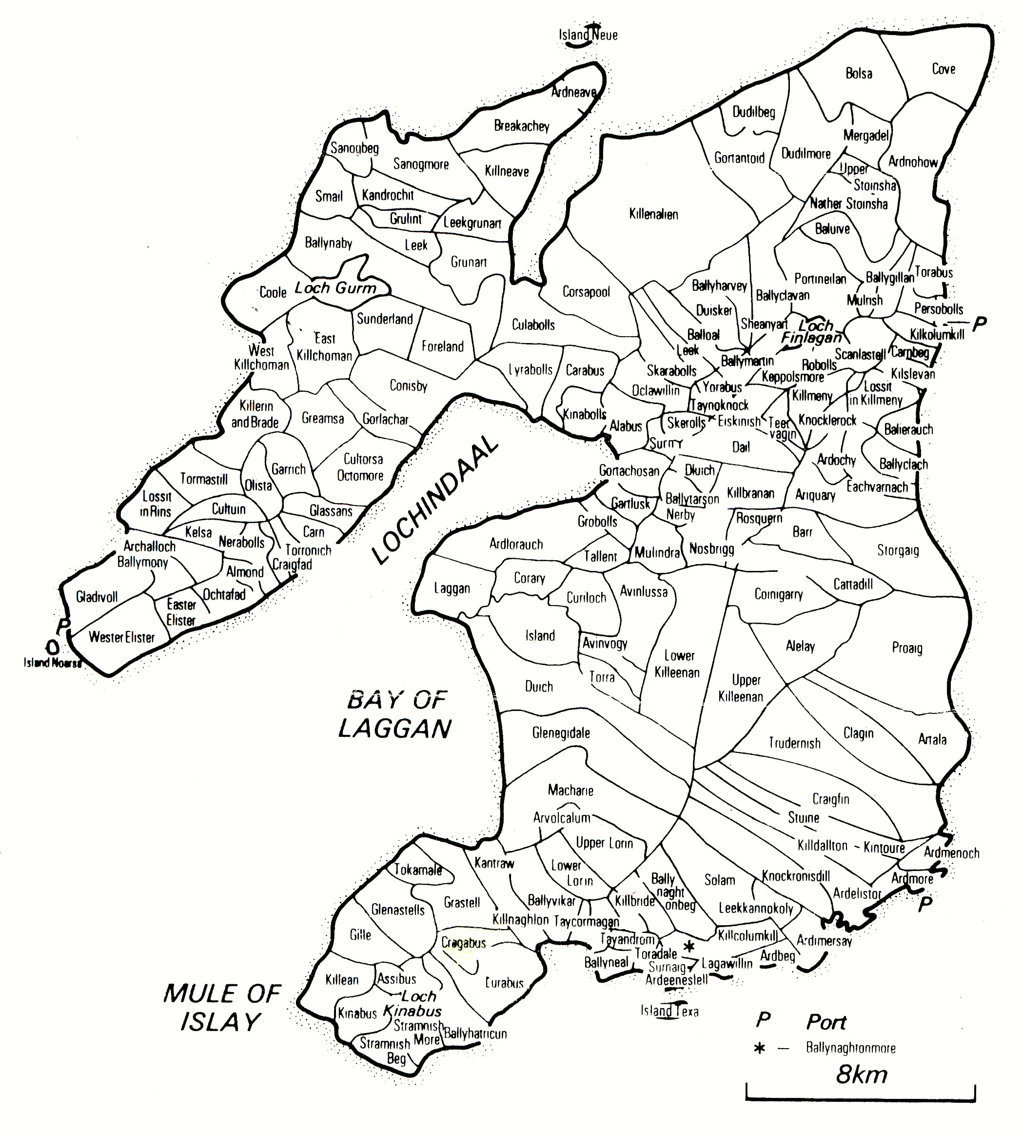
Here are two maps of the Isle of Islay The first one is a whopping 2096 x 2326 pixels, and weighs in at 737 Kb The second is the same map, however at a more palatable 1000 x 1110 pixels, and only a flyweight at 96 Kb If you have the patience, download the larger image. It will produce a good quality print-out if you desire! |

A very old map of Islay, "Ila Insvla", appears to be dated 1654
A regional map of the Scotland area
Find older places and locations using these web sites www.old-maps.co.uk
and www.streetmap.co.uk And check the collection at the National Library of Scotland - www.nls.uk/maps - thanks to Sue Visser!
|
Order a CD
 of 1878
Ordnance Survey Maps of Islay
of 1878
Ordnance Survey Maps of Islay