JACKSON COUNTY OHIO
 Jackson County Probate Court | ||||||||||||||||||||||||||||||


| Meetings are the third Monday of each month at 7:30 pm at the Jackson City Library. Library/Research materials are housed at the Jackson City Library during their regular hours |
Jackson County Boundary Changes
Jackson County Ohio's Community Web Site
OTHER INFORMATION
Jackson County is located about 60 miles southeast of Columbus. The county is named in honor of Andrew Jackson.
The county was settled by the Welsh people and in the early days Welsh was the language commonly spoken here. Jackson, the county seat, was once the center of the nation's silvery iron industry. It now houses one of the country's largest manufacturers of canned Chinese food products.
Probate Judge has birth, marriage & probate records; County Health Department has death & burial records; Clerk of Courts has divorce & civil court records; County Recorder has land records.
INFORMATIONAL LINKS
Bibliography (Includes detailed sources for all the information on this and the connected pages.)
Covered Bridges - Ohio
Discovering Family Histories - Ohio
Favorite Genealogy Web Links
Genealogy Look Up Forum
Hixson Plat Maps, Ohio Townships W. W. Hixson & Company, Rockford, Illinois
(These plat maps were published without dates or copyright notice,
but are believed to be from the 1920s and 1930s. The W. W. Hixson
Company published an Ohio Atlas around 1925 with individual County
maps and Township plat maps.)
Individual Ohio County Selection Table
Join the
Maggie_Ohio Mailing List! or the
OHROOTS-L Mailing List!
Maggie's World of Courthouse Dust & Genealogy Fever
OHGenWeb Archives
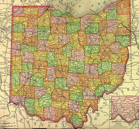
Ohio Clickable Map
Ohio County Courthouse Project
Ohio County Information Page
Ohio Government Mapping System - GNIS for land features, historical places
Ohio Memory An Online Scrapbook of Ohio History
Ohio Migration Trails
Ohio Network of American History and Research Centers (This is a descriptiong of the
central storage places for groups of Ohio counties.)
Ohio Tools for Genealogy Researchers
USGenWeb Project - Ohio
Vital Statistics (Includes Birth, Death, Marriage, Divorce, Land, Will & Estate Records.) This is an area
that explains where to look for vital records in the state of Ohio.
Hosted by RootsWeb


© 1997 - 2011 by
Maggie Stewart-Zimmerman
Probate Judge has birth, marriage & probate records; County Health Department has death & burial records; Clerk of Courts has divorce & civil court records; County Recorder has land records.
INFORMATIONAL LINKS
Bibliography (Includes detailed sources for all the information on this and the connected pages.)
Covered Bridges - Ohio
Discovering Family Histories - Ohio
Favorite Genealogy Web Links
Genealogy Look Up Forum
Hixson Plat Maps, Ohio Townships W. W. Hixson & Company, Rockford, Illinois
(These plat maps were published without dates or copyright notice,
but are believed to be from the 1920s and 1930s. The W. W. Hixson
Company published an Ohio Atlas around 1925 with individual County
maps and Township plat maps.)
Individual Ohio County Selection Table
Join the
Maggie_Ohio Mailing List! or the
OHROOTS-L Mailing List!
Maggie's World of Courthouse Dust & Genealogy Fever
OHGenWeb Archives
Ohio Clickable Map
Ohio County Courthouse Project
Ohio County Information Page
Ohio Government Mapping System - GNIS for land features, historical places
Ohio Memory An Online Scrapbook of Ohio History
Ohio Migration Trails
Ohio Network of American History and Research Centers (This is a descriptiong of the
central storage places for groups of Ohio counties.)
Ohio Tools for Genealogy Researchers
USGenWeb Project - Ohio
Vital Statistics (Includes Birth, Death, Marriage, Divorce, Land, Will & Estate Records.) This is an area
that explains where to look for vital records in the state of Ohio.
Hosted by RootsWeb
© 1997 - 2011 by
Maggie Stewart-Zimmerman
| Bibliography (Includes detailed sources for all the information on this and the connected pages.) |
| Covered Bridges - Ohio |
| Discovering Family Histories - Ohio |
| Favorite Genealogy Web Links |
| Genealogy Look Up Forum |
| Hixson Plat Maps, Ohio Townships W. W. Hixson & Company, Rockford, Illinois (These plat maps were published without dates or copyright notice, but are believed to be from the 1920s and 1930s. The W. W. Hixson Company published an Ohio Atlas around 1925 with individual County maps and Township plat maps.) |
| Individual Ohio County Selection Table |
| Join the Maggie_Ohio Mailing List! or the OHROOTS-L Mailing List! |
| Maggie's World of Courthouse Dust & Genealogy Fever |
| OHGenWeb Archives |
| Ohio Clickable Map |
| Ohio County Courthouse Project |
| Ohio County Information Page |
| Ohio Government Mapping System - GNIS for land features, historical places |
| Ohio Memory An Online Scrapbook of Ohio History |
| Ohio Migration Trails |
| Ohio Network of American History and Research Centers (This is a descriptiong of the central storage places for groups of Ohio counties.) |
| Ohio Tools for Genealogy Researchers |
| USGenWeb Project - Ohio |
| Vital Statistics (Includes Birth, Death, Marriage, Divorce, Land, Will & Estate Records.) This is an area that explains where to look for vital records in the state of Ohio. |
Hosted by RootsWeb